A practical guide to bird watching in Sonoma County, California
(Unless otherwise indicated, all phone numbers are in the 707 area code)
A practical guide to bird watching in Sonoma County, California
(Unless otherwise indicated, all phone numbers are in the 707 area code)

Annadel State Park, Santa Rosa CA
Location aliases: Locals and bird watchers generally shorten the name, simply referring to the park as "Annadel."
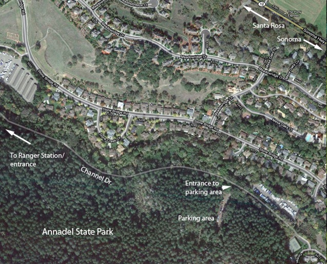
Location: Channel Dr., off of Montgomery Dr., Santa Rosa CA. Continue beyond the entrance to Spring Lake Park at Violetti Rd. on the right (off the map here, to the right. The map on the Channel Dr. page shows the area to the west of what is shown here). There is a parking area at approximately 6030 Channel Dr., Santa Rosa, CA 95409 outside the park (off the map to the left), which is free. The parking area within Annadel State Park, at the end of Channel Dr. (the parking area shown here) requires a $7 parking fee. See the Channel Dr. page for information about the section of Channel Dr. outside the park to the west.
GPS address: There is a ranger station at the formal entrance to the park (pay parking fee here using the envelopes provided). An address is not really required; once you're on Channel Dr., there's no where to go but into the park. The address for the Channel Dr. parking area above should suffice.
GPS Coordinates: 38 27 07N, 122 38 0W will take you approximately to the ranger station/entrance kiosk. The parking lot inside the park (quite a distance beyond the ranger station) is at 38 26 40N, 122 36 57W
Access: There is a $7 parking fee for entrance to Annadel State Park with a vehicle. It is possible to walk into the park for free, but it takes about half an hour to walk from the free parking area on Channel Dr. to the entrance to Annadel State Park. The entire area along Channel Dr. from the parking area and into Annadel State park is usually very good birding.
Suggested routes: Annadel State Park covers a very large area. This page does not attempt to cover the entire park. For general park information, see the California State Parks Website.
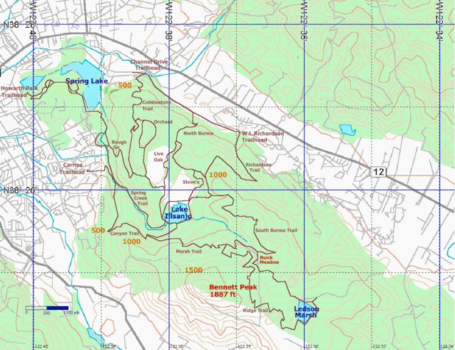
Other popular birding areas within Annadel State Park include trails that go around Lake Ilsanjo and trails that lead out to Ledsen Marsh (see trail map).
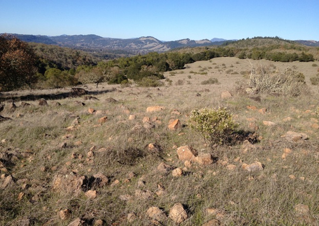
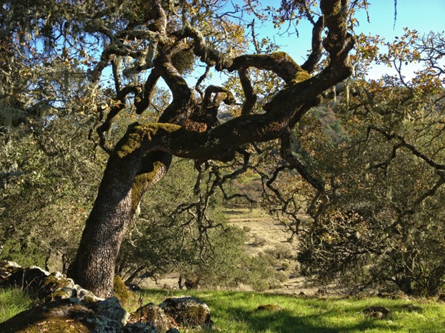
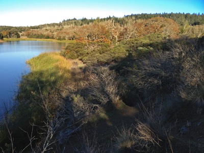
Habitats: Riparian woods (mature evergreens, mature oaks), creekside brush, grassland, upland meadows, residential. Channel Dr. (both within and outside the park proper) an be excellent for spring and autumn warblers.
Unusual birds, sightings: Yellow-bellied Sapsucker (1/3-1/4/2014, Kerry Wilcox); Townsend’s Solitaire (1/3/2014, Kerry Wilcox); Pileated Woodpecker often present.
Restroom facilities: Facilities at the Annadel State Park parking lot (parking fee required) at the end of Channel Dr. Also at Spring Lake Park (parking fee required), the entrance at Violetti Rd. being closest.
Restaurants nearby: East West Café at 557 Summerfield Rd. (546-6142) serves good Mediterranean-influenced meals with many vegetarian choices. Lepe's Taqueria at 4323 Montgomery Dr. (538-8891), about a minute further up Summerfield Rd. offers very good informal Mexican. Further afield: There is a deli in the Safeway at 2751 Fourth St. 522-1455. Michelle Marie's Patisserie, 2404 Magowan Dr. (575-1214) has sandwiches and full meals at lunchtime.
Nearby attractions: Extensive hiking, horseback riding, and mountain biking trails at Annadel State Park. Nearby Spring Lake offers swimming at the lagoon during the summer months (with lifeguards). Canoes, kayaks, other small (non-motorized) boats and paddle boats allowed on the main lake. Fishing (largemouth bass, sunfish, catfish; California fishing license required for those 16 and older). Hiking trails. Picnic areas. Campgrounds open seven days a week from May 1 through September 30, otherwise weekends and holidays only (539-8092 for information). Neighboring Howarth Park offers play areas for children, paddle-boating at Lake Ralphine; summer children's activities include a carousel, a miniature steam engine kids and adults can ride on, petting zoo, pony riding. Public tennis courts. Continuing beyond Howarth Park on Summerfield Rd. and then out Montgomery Dr. to the right will connect you with Highway 12 (also known as Sonoma Highway), which leads to the Sonoma Valley wine country with many excellent wineries. Bennett Valley Golf Club is at 3330 Yulupa Ave. (528-3673). Public tennis courts next door to the golf course at Galvin Park. There are one or two wineries also further out Bennett Valley Rd. beyond the golf course, the best known being Matanzas Creek Winery (6097 Bennett Valley Rd., 528-6464)--worth a visit for its lavender fields, usually in bloom in June.
Related bird watching spots: See the pages for Channel Dr. , Spring Lake Park, and Lake Ralphine, in Howarth Park. Melita Rd. is also nearby.
Notes: Watch out for poison oak in wooded areas here (and throughout the county).
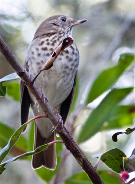
The bird in the photo: Hermit Thrush, January 22, 2011, Annadel State Park
All photos by the author, unless otherwise indicated
Maps by Google Maps
© Colin Talcroft, 2009, 2010, 2011, 2012, 2013.
Unless noted, all photos by the author. If you would like to use one of my images, please ask for permission for non-commercial use with proper credit or commercial use with proper compensation.